Getting Started With Python, Assignment 2.2 (Module 2 of 9)

This video assignment, provided by the GeoTech Center, is the second assignment from module two of the Python and Geospatial Mapping course, titled Getting Started. The course is designed for experienced users of Global Information Systems (GIS) platforms who are new to programming, with the goal of teaching them how to use Python to automate processes through the construction of short scripts in ArcGIS Pro.
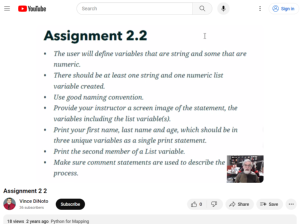
In this assignment, learners will create string and numeric variables along with string and numeric lists. Additionally, the assignment requires the use of naming conventions and script comments.
The video runs 2:34 minutes in length. Additional resources from the Python and Geospatial Mapping course are available to view separately.
About this Resource
Creator
Publisher
Date Issued
February 22nd, 2021
Audience
Education Level
Language
Subject
GEM Subject
Relation
Is Related To
ATE Contributor
Associated Files
Archived
Rights
Access Rights
STEMLink
Available in STEMLink
Comments