GUAS 2372 UAS 102 - Digital Mapping with UAS

Course Description:
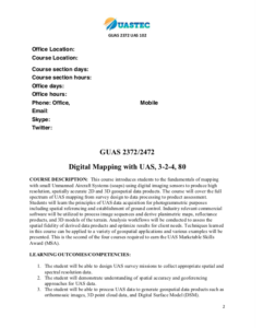
This course, developed by the Unmanned Aircraft Systems Technology Education Consortium (UASTEC) at Del Mar College, covers the fundamentals of digital mapping with Unmanned Aircraft Systems (UAS). "The course cover[s] the full spectrum of UAS mapping from survey design to data processing to product assessment." Course learning objectives and course competencies include:
- The student will be able to design UAS survey missions to collect appropriate spatial and spectral resolution data.
- The student will demonstrate understanding of spatial accuracy and georeferencing approaches for UAS data.
- The student will be able to process UAS data to generate geospatial data products such as orthomosaic images, 3D point cloud data, and Digital Surface Model (DSM).
Course Contents:
Course materials are provided in two .zip attachments. GUAS2372_UAS102.zip includes a syllabus, nine lecture modules, Pix4D and eMotion3 lab exercises, lab question and answer sheets, data files, and numerous images and supporting documents.
GUAS2372_UAS102_Canvas.zip includes numerous files and folders for the entire Canvas course.
The 6-page syllabus includes a course description; a list of course outcomes; a list of software, apps, and accounts needed; technology requirements; and more. The syllabus is available in .docx and .pdf format.
Lecture modules cover the following topics: UAS introduction and applications, platform selection, sensor payloads, the basics of digital imaging, the basics of digital cameras, camera calibration, elements of photogrammetry, structure from motion, and UAS mapping fundamentals. These lectures are available in .pdf and .pptx format.
The following four Pix4Dlab exercises are included:
- Processing UAS Imagery with Pix4D - Generate a DEM and Orthomosaics of Ward Island beach.
- Processing UAS Imagery with Pix4D Generate a DSM and DTM of a Parking Lot
- Processing UAS Imagery with Pix4D - Generating a Canopy Height Model
- Processing Multispectral Imagery Data in Pix4D - Generating a NDVI Index for Crop Health Monitoring
The lab documents may include an objective, a task description, information about the data set, and lab steps. Supporting data and question and answer documents are also provided for the labs.
The following eMotion3 labs are also included in the course:
- Intro - UAS Systems and Capabilities
- How to plan and create a flight
- How to use the Flight Simulator
- Fundamentals Step by step Independent Practice.
The labs documents include an objective, deliverables, directions, and more. Question and answer sheets are also provided for the labs. Most of the eMotion and Pix4D labs are available in .pdf and .docx formats.
Course materials also include commercial supporting documents and many images.
For orientation purposes the syllabus is included as a separate attachment and offers a sample of the type of material included in this course.
Below is a list of the folders contained within the .zip attachments. The size of each folder and number of files is included in parenthesis.
GUAS2372_UAS102 (1,115 files 3.7 GB)
- GUAS_Supporting_Documents_Commercial
- Creating Quality GCPs for Mapping Contour Lines (GUAS2372_Doc_CommercialDroneMappingPilotsAssociation_GCP.docx 2.4 MB)
- Pix4D Guided Practice Example Projects (GUAS2372_Doc_Pix4D_ProjectTutorials.docx 12 MB)
- Pix4D Tutorial Videos/ Video Academy (GUAS2372_Doc_Pix4D_VideoAcademy.docx 1.1 MB)
- Drone Mapping Accuracy Part I Ground Control Points (GCP)(GUAS2372_Doc_VerticleAspectPart1_GCP.docx 3.4 MB)
- Suggested Supporting Documents Commercial Bibliography (Supporting Documents Commercial Bibliography.docx 17 KB)
- GUAS2372_UAS102_Lecture_Modules
- Module 1 UAS Introduction and Applications (GUAS 2372 UAS2 - Module 1.pptx 57.5 MB)
- Module 2 Platform Selection: Fixed-Wing or Rotary (GUAS 2372 UAS2 - Module 2.pptx 76.5 MB)
- Module 3 Sensor Payloads (GUAS 2372 UAS2 - Module 3.pptx 184.7 MB)
- Module 4 Basics of Digital Imaging (GUAS 2372 UAS2 - Module 4.pptx 10.7 MB)
- Module 5 Basics of Digital Cameras (GUAS 2372 UAS2 - Module 5.pptx 2.9 MB)
- Module 6 Camera Calibration (GUAS 2372 UAS2 - Module 6.pptx 3.1 MB)
- Module 7 Elements of Photogrammetry (GUAS 2372 UAS2 - Module 7.pptx 9.4 MB)
- Module 8 Structure from Motion (SfM) (GUAS 2372 UAS2 - Module 8.pptx 17 MB)
- Module 9 UAS Mapping Fundamentals (GUAS 2372 UAS2 - Module 9.pptx 17.6 MB)
- GUAS2372_UAS102_Mod_Lec_Support_Docs
- GUAS2372_UAS102_Pix4D_Labs
- GUAS_Pix4D_CoverPages (5 files, 3.5 MB)
- Lab 1: Processing UAS Imagery with Pix4D - Generate a DEM and Orthomosaics of Ward Island beach (GUAS_Pix4D_Lab_1A_L1_Workflow.docx
- Lab 5: Processing UAS Imagery with Pix4D - Generate a DSM and DTM of a Parking Lot (GUAS_Pix4D_Lab_5_L2_Workflow.docx
- Lab 6: Processing UAS Imagery with Pix4D - Generating a Canopy Height Model (GUAS_Pix4D_Lab_6_L3_ Workflow.docx
- Lab 7 (L4): Processing Multispectral Imagery Data in Pix4D - Generating a NDVI Index for Crop Health Monitoring (GUAS_Pix4D_Lab_7_L4_Workflow.docx
- GUAS_Pix4D_Labs_QandA_Sheets (15 files, 6.7 MB)
- GUAS_Pix4D_Supporting_Docs (2 files, 29 KB)
- Pix4D_Lab4_L1_Ward_IslandBeach_Data (2 files, 29 KB)
- Pix4D_Lab5_L2_DSM_DTM_PakingLot_Data (65 files, 265.9 MB)
- Pix4D_Lab6-L3_GeneratingCanopyHtMod_Data (414 files, 1.87 GB)
- Pix4D_Lab7_L4_NDVI_Index_CropHealth_Data (406 files, 604.9 MB)
- UASTEC_Pix4D_Extended_Lab_Steps (5 files, 26 MB)
- GUAS2372_UAS102_Syllabus_Modules
- Course Syllabus (GUAS2371_UAS101_Course Syllabus.docx 1 MB)
- Canvas Module List (GUAS2371_UAS102_CanvasModules.docx 1.3 MB)
- GUAS2372_UAS103_eMotion3_Labs
- Lab 1 A: Introduction to eMotion 3 - How to plan and create a flight (eMoLab1A_Workflow.pdf 2.6 MB)
- Lab 2: Introduction to eMotion 3 How to use the flight simulator (eMoLab2A_Workflow.pdf 556 KB)
- Lab Intro 0: UAS Systems and Capabilities (eMotion3Lab0_Overview_Workflow.docx 791 KB)
- Lab 1 B, Emotion3 Fundamentals Step by step Independent Practice (eMotion3Lab1B_Workflow.docx 2.6 MB)
- Lab 1 B, Emotion3 Fundamentals Step by step Independent Practice (eMotion3Lab2B_Workflow.docx 2.6 MB)
- Lab 3A: Introduction to eMotion 3 - How to create a corridor flight plan (eMotion3Lab3A_VideoLab.pdf 5.8 MB)
- Lab3B: Introduction to eMotion 3 Lab - How to create a corridor flight plan (eMotion3Lab3B_Workflow.docx 92 KB)
- Lab 3 C: Independent Practice, Build your own Corridor (eMotion3Lab3C_Workflow.docx 79 KB)
- UASTECeMotion3_CoverPages (19 files, 10 MB)
- UASTECeMotion3_ExtendedSteps (3 files, 9.6 MB)
- UASTECeMotion3_Questions (10 files, 1.6 MB)
GUAS2372_UAS102_Canvas (3 files, 1.57 GB)
- (guas-2372-slash-guas-102-slash-ate-nsf-export.imscc 1.57 GB)
- (guas-2372-slash-guas-102-slash-ate-nsf-quiz-export.zip 3 KB)
About this Resource


Comments