Browse Resources
Resources |
|---|
 In this video, created by Support Center for Microsystems Education (SCME), viewers are introduced to the concept of DNA microarray fabrication. Specific topics include: non-contact printing process, photolithography process and maskless photolithography process. This is the third in a series of...
This video, published by Sinclair Community College, is part of the video series Complex Concepts, Simply Put. This series explores programming concepts to augment the training of prospective IT technicians.
In this video, viewers learn about doing basic math in C++. The video begins with a math...
 This video, from Columbia Gorge Community College, is the first of a two-part series on doubly fed induction generators (DFIG). In the video, instructor Jim Pytel introduces the concept of DFIGs and contrasts them with traditional synchronous and induction generators.
During the video, Pytel...
 This video, from Columbia Gorge Community College, is the second of a two-part series on doubly fed induction generators (DFIG). In the video, instructor Jim Pytel introduces the concept of DFIGs and contrasts them with traditional synchronous and induction generators.
During the video, Pytel ...
 This video, published by Columbia Gorge Community College, is the first part of a two part lecture on doubly fed induction motors. The lecture examines the construction, operation, and different operational modes of doubly fed induction motors. Also discussed is how varying rotor excitation...
 This video, published by Columbia Gorge Community College, is the second part of a two part lecture on doubly fed induction motors. The lecture examines the construction, operation, and different operational modes of doubly fed induction motors. Also discussed is how varying rotor excitation...
 This video, provided by Virginia Geospatial Extension, is part of a series of 28 tutorial videos on remote sensing with ArcGIS Pro. This tutorial "provide[s] step by step instructions for downloading Landsat 8 imagery via USGS's EarthExplorer website." This video runs 10:45 minutes in length. The...
 This tutorial, provided by Virginia Geospatial Extension, is part of a series of 30 videos that cover remotely sensed data in ArcMap 10.x versions. This video demonstrates viewing and downloading Landsat imagery using Earth Explorer. The video runs 01:55 minutes in length. The other videos in the...
 This tutorial, provided by Virginia Geospatial Extension, is part of a series of 30 videos that cover remotely sensed data in ArcMap 10.x versions. Tutorial seven is divided into four videos: A, B, C, and D. This video demonstrates using the GLOVIS viewer. This video runs 02:32 minutes in length....
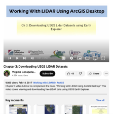 This video, provided by Virginia Geospatial Extension, is part of a series of 16 tutorial videos on using Lidar with ArcGIS Desktop. This tutorial demonstrates how to download Lidar datasets from the United States Geological Survey (USGS) using Earth Explorer. This video runs 03:58 minutes in...
|
| ← PreviousNext → |