Browse Resources
Resources |
|---|
 This post on the AmericaView Blog describes accessing Landsat data and using it in the ArcGIS program. The post includes a link to an instructional video which will show you how to access freely available Landsat satellite imagery and data and then work with it in ArcGIS. Running time for the video...
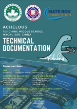 This 22-page report, published by Pensacola Catholic High School, describes the design and construction of the underwater remotely operated vehicle (ROV) created by the Achelous team for the Ranger Class of the 2023 MATE ROV competition. MATE ROV is a global competition that challenges STEM students...
 This 1-page document, from the Advanced Technology Environmental and Energy Center (ATEEC), is a learning activity where students gain the opportunity to use analytical meters and instruments to perform acid deposition sampling. In the activity, students collect samples from various sources over a...
 This 15-page document, made available by the STEM Guitar Project, is an activity on cost estimates and the anatomy of acoustic guitars. During the activity students "calculate the cost and quantity of the following components: soundbox or body back, sides, top, interior bracing and kerfing,...
 In this professional development video from Getting Results, Dr. John Bransford, professor of education at the University of Washington School of Education, and an instructor talk about how to engage students. Bransford says engagement involves getting students interested in working on problems they...
 This 7-page activity is provided by the GeoTech Consortium of Western New York: Get the GIST (Geospatial Information Science Technology) Certificate and is intended as a professional development activity. The activity includes step-by-step instructions which involve creating a new map, adding layers...
 This 4-page activity is provided by the GeoTech Consortium of Western New York: Get the GIST (Geospatial Information Science Technology) Certificate and is intended to help users turn spreadsheet data into map layers. During the activity users will create a new ArcGIS map layer from a CSV file of...
 This 7-page activity is provided by the GeoTech Consortium of Western New York: Get the GIST (Geospatial Information Science Technology) Certificate and is intended as a professional development activity. The activity includes background information on state-regulated dams in New York State and...
 In this 12-page activity, provided by the GeoTech Consortium of Western New York: Get the GIST (Geospatial Information Science Technology) Certificate, users explore lava hazard zones using a map in ArcGIS. The activity includes an introduction and step-by-step instructions. The instructions involve...
 This Additive Manufacturing Basics site from AMazing Additive Manufacturing gives an overview of additive manufacturing (AM) history and technologies. The site introduces common AM technologies such as the use of a computer, 3D modeling software (Computer Aided Design or CAD), machine equipment and...
|
| ← PreviousNext → |