Browse Resources
Instructional Material -- Syllabus
Resources |
|---|
This webpage, provided Western Washington University and authored by Professor Jeff Newcomer, details Professor Newcomer's instruction on the topic of ethical decisions in the engineering field. The webpage has an introduction to the topic and a series of four syllabi that can be used for providing...
This 3-page outline provides information about the ENRG 51: Excel for Energy Auditing course that's part of the Commercial Building Energy Analysis and Audits program at City College of San Francisco. This program is intended to prepare students to conduct energy audits, evaluate building systems...
This 5-page outline provides information about the ENRG 56: Building Envelope Systems course that's part of the Commercial Building Energy Analysis and Audits program at City College of San Fancisco. This program is intended to prepare students to conduct energy audits, evaluate building systems for...
Program Description:
River Valley Community College, in association with Program Development in Cybersecurity with Focus on Business and Healthcare Concepts, has developed a 4-semester program to prepare students to working the Information Assurance (IA) field with a focus on Cybersecurity and...
Course Description:
This course, titled Experimental Testing of Vehicles and provided by the Center for Advanced Automotive Technology (CAAT), is designed for community college students and automotive test technicians in the area of vehicle experimental testing. It is suitable for inclusion in an...
These resources include a 4-page syllabus and a 2-page course table map for the Exploring Our World Through Geospatial Technology course taught at Weber State University. "This ... exploratory course introduces [students] to the fundamental concepts of Geospatial Science and how Geospatial...
This 7-page syllabus and 4-page course outcome summary, published by Northeast Wisconsin Technical College (NWTC), provide information on the Fiber Optic Splicing & Testing Procedures course offered by NWTC. The course provides opportunities for students to "apply their skills to splice, test, and...
This 4-page syllabus, published by Heartland Community College (HCC), provides information about the Fluid Power and Mechanical Systems course taught at HCC. Throughout the course, students study "basic fluid power theories and advantages, schematic reading and development, equipment specification...
Program Description:
River Valley Community College, in association with Program Development in Cybersecurity with Focus on Business and Healthcare Concepts, has developed a 4-semester program to prepare students to working the Information Assurance (IA) field with a focus on Cybersecurity and...
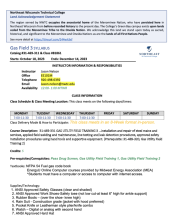
This 10-page syllabus, published by Northeast Wisconsin Technical College (NWTC), provides information about the Gas Field 3 course taught at NWTC. During this class, students learn about installation and repair of steel mains and services, applied field welding and maintenance, line testing and...
|
| ← PreviousNext → |

