Browse Resources
Instructional Material -- Student Guide
Resources |
|---|
 Module Description:
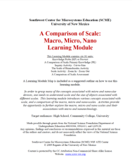
This module, from Support Center for Microsystems Education (SCME), introduces "various concepts associated with scale, and a comparison of the macro, micro and nano-scales." This module is divided into the following six units: Knowledge Probe (KP) or Pre-test, Comparison of...
 This lesson plan, from the Contextualize to Learn project at the University of Wisconsin-Madison, is an exploration in the addition of decimal numbers. In this lesson, students work individually and in pairs to solve application problems using multiple methods. Included in the lesson plan is a...
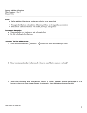 This lesson plan, from the Contextualize to Learn project at the University of Wisconsin-Madison, provides an opportunity for students to explore adding fractions with like and unlike denominators. In this lesson, students work in pairs to demonstrate the addition of fractions utilizing models,...
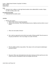 This lesson plan, from the Contextualize to Learn project at the University of Wisconsin-Madison, provides an opportunity for students to add natural numbers together. In the activity, students work in pairs to add two multi-digit natural numbers, where addends differ in number of digits. Included...
 This collection, from the Advanced Technology Environmental and Energy Center (ATEEC), focuses on student activities based the impact of invasive species on ecosystems. The first document is a teachers' guide containing a textbook assignment along with instructions for student PowerPoint...
 Learning Unit Description:
The Integrated Geospatial Education and Technology Training Project (iGETT) presents a series of Learning Units (LU) designed to incorporate federal land remote sensing data into Geographic Information System (GIS) instruction. The Analyzing Crop Development Patterns in...
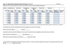 This lesson, developed by Cindy Nestel of Summit Middle School, is designed to be a follow-up lesson to "Which Rare Earth Element Will Be Named 'The Element of the Year?'" The lesson serves as an integrated science and math activity, in which students analyze data about rare earth elements and read...
 Learning Unit Description:
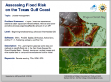
The Integrated Geospatial Education and Technology Training Project (iGETT) presents a series of Learning Units (LU) designed to incorporate federal land remote sensing data into Geographic Information System (GIS) instruction. The Flood Risk Assessment LU, by Barbara...
 Learning Unit Description:
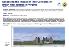
The Integrated Geospatial Education and Technology Training Project (iGETT) presents a series of Learning Units (LU) designed to incorporate federal land remote sensing data into Geographic Information System (GIS) instruction. The Assessing the Impact of Tree Canopies...
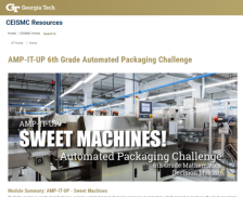 This resource, published by Georgia Tech Research Institute, features a mathematics activity designed for sixth graders. In this activity, students examine candy manufacturing processes to determine the most consistent process, building both math and decision making skills. Students will use "...
|
| Next → |