Browse Resources
Instructional Material -- Lesson/Lesson Plan
Resources | |
|---|---|
This 43-page module is provided by Dniepropetrovsk State Agrarian University (Ukraine) and AgrowKnowledge and includes materials and activities intended for use in a college classroom. This module "contains basic information about the tools, processes and benefits of the use of geospatial...
This resource, provided by the GeoTech Center, is the first of nine online modules in the Python and Geospatial Mapping course. Designed for experienced users of Global Information Systems (GIS) platforms who are new to programming, this course aims to teach learners how to use Python to automate...
This resource, provided by the GeoTech Center, is the .pdf version of the first of nine online modules in the Python and Geospatial Mapping course. Designed for experienced users of Global Information Systems (GIS) platforms who are new to programming, this course aims to teach learners how to use...
Learning Unit Description:
Integrated Geospatial Education and Technology Training (iGETT) presents a series of Learning Units (LU) designed to incorporate federal land remote sensing data into Geographic Information Systems (GIS) instruction. This LU covers the use of GIS to detect land change...
Learning Unit Description:
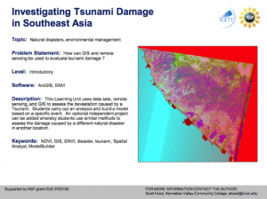
The Integrated Geospatial Education and Technology Training Project (iGETT) presents a series of Learning Units (LU) designed to incorporate federal land remote sensing data into Geographic Information System (GIS) instruction. The Investigating Tsunami Damage in...
This document provides a learning module on iron and steel for use in materials education. The lesson examines the basic properties of iron and steel and includes discussions, demonstrations and suggested optional classroom activities. The materials can be covered in one to two class periods.
In this lesson from The Lane Community College MAPS GIS program, students will find cities in the United States that are of similar size to Eugene, OR and compare attributes such as crime rate, land area, etc. using box and whisker plots. Prior to the lesson, the instructor will use a computer and...
This lab, presented by the National Nanotechnology Infrastructure Network, introduces students to the difficulty to of measuring at the nanoscale. Accuracy and precision are the most important principles or measuring at such a small scale, and with the growing demand for nanotechnology careers, an...
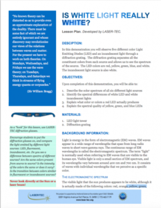
This 2-page lesson plan outlines how an instructor can demonstrate how a diffraction grating "separates all the constituent colors from each source and allows us to see the spectrum of the source." This lesson plan includes a short description, a list of objectives, background information, and a...
TeachEngineering.org is a searchable, web-based digital library populated with standards-based engineering curricula for use by K-12 teachers and engineering faculty. The content in this resource includes activities, lessons, curriculum units, and living labs. Content can be browsed by subject,...
| |
| ← Previous | Next → |
