Browse Resources
Instructional Material -- Activity
Resources | |
|---|---|
This video assignment, provided by the GeoTech Center, is the first assignment from module eight of the Python and Geospatial Mapping course, titled More Python. The course is designed for experienced users of Global Information Systems (GIS) platforms who are new to programming, with the goal of...
This video assignment, provided by the GeoTech Center, is the second assignment from module eight of the Python and Geospatial Mapping course, titled More Python. The course is designed for experienced users of Global Information Systems (GIS) platforms who are new to programming, with the goal of...
This video assignment, provided by the GeoTech Center, is the third assignment from module eight of the Python and Geospatial Mapping course, titled More Python. The course is designed for experienced users of Global Information Systems (GIS) platforms who are new to programming, with the goal of...
This video assignment, provided by the GeoTech Center, is the fourth assignment from module eight of the Python and Geospatial Mapping course, titled More Python. The course is designed for experienced users of Global Information Systems (GIS) platforms who are new to programming, with the goal of...
This video assignment, provided by the GeoTech Center, is the sixth assignment from module eight of the Python and Geospatial Mapping course, titled More Python. The course is designed for experienced users of Global Information Systems (GIS) platforms who are new to programming, with the goal of...
This video assignment, provided by the GeoTech Center, is the seventh assignment from module eight of the Python and Geospatial Mapping course, titled More Python. The course is designed for experienced users of Global Information Systems (GIS) platforms who are new to programming, with the goal of...
This video case study assignment, provided by the GeoTech Center, is the first case study from module eight of the Python and Geospatial Mapping course, titled More Python. The course is designed for experienced users of Global Information Systems (GIS) platforms who are new to programming, with the...
This video case study assignment, provided by the GeoTech Center, is the second case study from module eight of the Python and Geospatial Mapping course, titled More Python. The course is designed for experienced users of Global Information Systems (GIS) platforms who are new to programming, with...
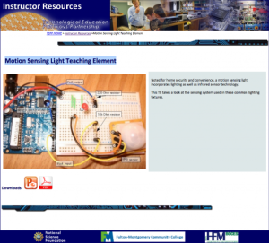
These slides, from the Technological Education Pathways Partnership (TEPP), lead students in a teardown activity to examine the components of a motion sensing light device. Wiring is exposed to add a manual toggle switch and then measure voltage and current. This setup can the be used to compare the...
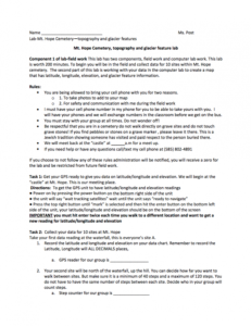
This 2-page resource is the first part in a two part lab activity and is provided by the GeoTech Consortium of Western New York: Get the GIST (Geospatial Information Science Technology) Certificate. In this lab users will collect field data from Mt. Hope Cemetery. In the second part users will use...
| |
| ← Previous | Next → |


