Browse Resources
Information and Security Technologies -- Geospatial technologies
Resources |
|---|
This video, from the Integrated Geospatial Education and Technology Training Project (iGETT), is the third part of a three-part presentation on spatial filters in remote sensing. It uses review questions assess understanding of the content of the first two videos. The video is six minutes long and...
This video, provided by Virginia Geospatial Extension, is part of a series of 28 tutorial videos on remote sensing with ArcGIS Pro. This tutorial "uses ArcGIS Pro version 2.3.3 to illustrate Spectral enhancement of Landsat 8 Imagery, it discusses NIR/R, sqrt(NIR/R) and NDVI using Raster Functions,...
This tutorial, provided by Virginia Geospatial Extension, is part of a series of 30 videos that cover remotely sensed data in ArcMap 10.x versions. This tutorial is divided into two videos (16A and 16B). The "tutorial covers spatial enhancement of Landsat Imagery." Band ratios and vegetation indices...
This tutorial, provided by Virginia Geospatial Extension, is part of a series of 30 videos that cover remotely sensed data in ArcMap 10.x versions. This tutorial is divided into two videos (16A and 16B). The "tutorial covers spatial enhancement of Landsat Imagery." Band ratios and vegetation indices...
This video, provided by Virginia Geospatial Extension, is part of a series of 28 tutorial videos on remote sensing with ArcGIS Pro. This tutorial "uses ArcGIS Pro version 2.3 to illustrate spectral enhancement of Landsat 8 imagery including raster functions." This video runs 08:08 minutes in length....
This video, from the Integrated Geospatial Education and Technology Training Project (iGETT), introduces viewers to spectral resolution in a geospatial context. The presentation touches on historic information before covering the electromagnetic spectrum, atmospheric windows, and sensors. The video...
This video, created by Integrated Geospatial Education and Technology Training Project (iGETT), discusses the use of spectral signatures in the analysis of remote sensing imagery. Topics covered include the following: what is remote sensing, spectral signature defined, electromagnetic spectrum,...
This module is provided by GeoTech Center and introduces statistical concepts that are related to geospatial technologies. Module contents include a video recording, a PowerPoint presentation, and a quiz that reviews the content presented in the module.
The Concept Module Video is a recorded...
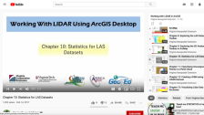
This video, provided by Virginia Geospatial Extension, is part of a series of 16 tutorial videos on using Lidar with ArcGIS Desktop. This tutorial demonstrates statistics for LAS datasets. This video runs 09:22 minutes in length. The other videos in the series are available to view...
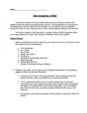
In this 7-page activity, provided by the GeoTech Consortium of Western New York, students will identify a famous true crime case and create an ArcGIS storymap with geographic locations related to the case. The activity includes instructions and spaces note the location and evidence found for each...
|
| ← PreviousNext → |
