Browse Resources
Information and Security Technologies -- Geospatial technologies
Resources |
|---|
This video, from the Integrated Geospatial Education and Technology Training Project (iGETT), is the second video in a two part concept module that focuses on correcting Landsat 8 Operational Land Imager (OLI) and Thermal Infrared Sensor (TIRS) imagery. This concept module discusses correcting "... ...
This video, from the Integrated Geospatial Education and Technology Training Project (iGETT), is the first of a two part concept module that focuses on correcting digital numbers (DN) for the two types of sensors on Landsat 8. The sensor Operational Land Imager (OLI) corrected to Top of Atmosphere...
This video from AmericaView explores Landsat Analysis Ready Data (ARD). In the video, R. Douglas Ramsey from UtahView at the Remote Sensing and GIS Laboratory at Utah State University provides a general introduction to Landsat ARD and discusses data organization, data products, analysis strategies,...
This video, provided by Virginia Geospatial Extension, is part of a series of 16 tutorial videos on using Lidar with ArcGIS Desktop. This tutorial demonstrates how to understand LAS dataset properties in ArcMap, one of the software applications of ArcGIS Desktop, and how to alter the display...
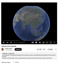
This video, created by Andy Jensen and narrated by Shant Salakian, provides a brief introduction to latitude and longitude. Salakian explains how latitude and longitude are used to describe locations on the surface of the earth. The video runs 03:14 minutes in length.
This video, from the 2021 Esri Education Summit, provides a panel about GIS library instruction and collaboration. The benefits of collaborating with librarians, the types of library GIS services, GIS librarian roles, and curriculum design are highlighted. Perspectives from educators and librarians...
This video, provided by Virginia Geospatial Extension, is part of a series of 22 tutorial videos on working with Lidar using ArcGIS Pro. This video demonstrates the following four search techniques: Address/Place, Current Extent, Box/Point, Coordinates, and Unique Identifier. This video runs 05:45...
This video, provided by Virginia Geospatial Extension, is part of a series of 22 tutorial videos on working with Lidar using ArcGIS Pro. This tutorial introduces settings that control display of lidar points and demonstrates displaying Lidar Datasets by classification code and return. This video...
This video, provided by Virginia Geospatial Extension, is part of a series of 22 tutorial videos on working with Lidar using ArcGIS Pro. This tutorial discusses overlay issues with basemaps and lidar data; illustrates symbology of lidar data by elevation and return number; and demonstrates tools to...
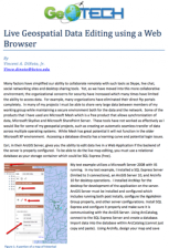
This two page document from GeoTech describes how to use a web browser for geospatial data editing. The ArcGIS Server software from Esri provides this technology. For live map editing, a relational database, such as the free SQL Express, must be used as the "storage container." A diagram illustrates...
|
| ← PreviousNext → |
