Browse Resources
Information and Security Technologies -- Geospatial technologies
Resources |
|---|
This video, provided by Virginia Geospatial Extension, is part of a series of 28 tutorial videos on remote sensing with ArcGIS Pro. This tutorial "uses ArcGIS Pro version 2.3 to discuss imagery and data stored by the USGS." This video runs 03:23 minutes in length. The other videos in the series are...
This video, created by Integrated Geospatial Education and Technology Training Project (iGETT), discusses the four types of resolutions important when acquiring or using remote sensing imagery. The four types of resolutions include: spatial, spectral, radiometric, and temporal. Each resolution is...
This 9-page booklet provides guidance for using Google Earth and NASA World Wind as tools in teaching. Instructions for navigating the programs are included. This booklet includes six sections: Introduction, Google Earth, NASA World Wind, Examples of Imagery Use, Application of World Wind, and...
Learning Unit Description:
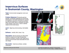
The Integrated Geospatial Education and Technology Training Project (iGETT) presents a series of Learning Units (LU) designed to incorporate federal land remote sensing data into Geographic Information System (GIS) instruction. The A Beginning Assessment Comparing...
This video, provided by Virginia Geospatial Extension, is part of a series of 28 tutorial videos on remote sensing with ArcGIS Pro. This tutorial "uses ArcGIS Pro version 2.3 to illustrate how to interpret metadata that accompanies a Landsat scene" This video runs 07:32 minutes in length. The other...
This tutorial, provided by Virginia Geospatial Extension, is part of a series of 30 videos that cover remotely sensed data in ArcMap 10.x versions. This video covers accessing and viewing metadata. This video runs 01:32 minutes in length. The other videos in the series are available to view...
This video, created by Integrated Geospatial Education and Technology Training Project (iGETT), covers how infrared radiation is used in remote sensing and by plants, animals, and humans. The video covers "the band values for infrared radiation and how the information can be used in astronomy and...
This resource, provided by the GeoTech Center, is the sixth of nine online modules in the Python and Geospatial Mapping course. The course is designed for experienced users of Global Information Systems (GIS) platforms who are new to programming, with the goal of teaching them how to use Python to...
This video assignment, provided by the GeoTech Center, is from module six of the Python and Geospatial Mapping course, titled Inputting Data. The course is designed for experienced users of Global Information Systems (GIS) platforms who are new to programming, with the goal of teaching them how to...
This video, from the 2021 Esri Education Summit, highlights new geospatial technologies and their applications. In the video, Krystle Harrell from Westpoint describes ArcGIS Pro and how it can modernize an undergraduate GIS curriculum. Harrell discusses the transition into ArcGIS Pro, learning tools...
|
| ← PreviousNext → |
