Browse Resources
Information and Security Technologies -- Geospatial technologies
Resources |
|---|
 The Environmental Systems Research Institute (ESRI) presents GeoInquiries, a database of educational resources on GIS technology and other general education topics. "Lessons include learning objectives, technical "how-to's", textbook references, and formative whole-class assessment items - all...
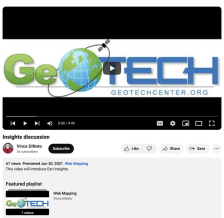 This video is provided by GeoTech and is part of a series on web mapping. During this video, the presenter discusses Esri Insights by showcasing a simple Insights page on wineries. Esri Insights is a data analytics and visualization tool that allows users to create dynamic maps, charts, and...
 This site is ESRI's home on YouTube. Users may view videos on the topics of ArcGIS, careers and opportunities at ESRI and the role of GIS in the larger world. The videos range in length and flash is required to view them.
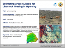 Learning Unit Description:
The Integrated Geospatial Education and Technology Training Project (iGETT) presents a series of Learning Units (LU) designed to incorporate federal land remote sensing data into Geographic Information System (GIS) instruction. The Estimating Areas Suitable for...
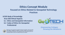 This module is provided by GeoTech Center, and discusses concepts related to ethics in geographic information systems. Module contents include a video recording, the PowerPoint presentation featured in the video, and a module overview document.
The Ethics Concept Module is a recorded PowerPoint...
 Learning Unit Description:
The Integrated Geospatial Education and Technology Training Project (iGETT) presents a series of Learning Units (LU) designed to incorporate federal land remote sensing data into Geographic Information System (GIS) instruction. The Evaluating Insect Damage to Forest...
 Exercise Description:
This exercise, created by the Integrated Geospatial Education and Technology Training Project (iGETT), uses real-world examples of drought damage and environmental issues caused by insect infestation to determine whether Geographic Information System (GIS) technology can be...
 This video, provided by Virginia Geospatial Extension, is part of a series of 28 tutorial videos on remote sensing with ArcGIS Pro. This tutorial is the second of three that cover supervised classification. This tutorial provides an introduction to supervised classification and spectral profiles of...
 This video, provided by Virginia Geospatial Extension, is part of a series of 28 tutorial videos on remote sensing with ArcGIS Pro. This tutorial "... demonstrates how to evaluate normality of training samples with Histograms in ArcGIS Pro version 2.3.3." This video runs 05:29 minutes in length. The...
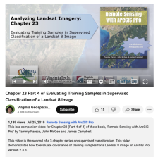 This video, provided by Virginia Geospatial Extension, is part of a series of 28 tutorial videos on remote sensing with ArcGIS Pro. This tutorial "... demonstrates how to evaluate covariance of training samples for a Landsat 8 image in ArcGIS Pro version 2.3.3." This video runs 04:07 minutes in...
|
| ← PreviousNext → |