Browse Resources
Resources |
|---|
This webpage, provided by the U.S. Geological Survey, is part of the Water Science for Schools. The page information about types of wells, drilling and water levels. Links to many other water-related sites are also included.
This podcast is hosted by Temple Grandin and is provided by the STEM Action Center. This podcast features STEM professionals discussing their work and the benefits of a multifaceted approach to STEM education. During episode eight of season two, Temple Gradin speaks with John Luft, Great Salt Lake...
This podcast is hosted by Temple Grandin and is provided by the STEM Action Center. This podcast features STEM professionals discussing their work and the benefits of a multifaceted approach to STEM education. During episode seven of season two, Temple Gradin speaks with Bonnie Baxter, Founder of...
The International Lake Environment Committee (ILEC) works to advance international cooperation for sustainable management of the world's lakes and reservoirs through the collection and provision of environmental data, the promotion of scientific research, and the promotion of interchange with...
This video, provided by Virginia Geospatial Extension, is part of a series of 22 tutorial videos on working with Lidar using ArcGIS Pro. This tutorial "... explore[s] the context sensitive toolbars and associated tabs when selecting a layer in Contents." This video runs 02:20 minutes in length. The...
This PowerPoint presentation is provided by AgrowKnowledge and includes information on global warming and carbon sequestration. The presentation defines global warming and discusses contributing factors and the consequences of global warming. The following slide topics are included: Global Warming,...
This site from the Science Education Resource Center at Carleton College provides a number of resources for teachers of introductory geoscience courses. Lesson plans include topics like the history of geology, causes and implications of global change, global sustainability, physical geology and the...
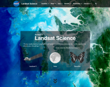
This is the U.S. National Aeronautics and Space Administration's launch page for all things related to Landsat science education. The Landsat program has been collecting spectral information of the earth's surface for over 40 years--the longest continual record of images of our planet. This website ...
This video, provided by Virginia Geospatial Extension, is part of a series of 16 tutorial videos on using Lidar with ArcGIS Desktop. This tutorial demonstrates how to understand LAS dataset properties in ArcMap, one of the software applications of ArcGIS Desktop, and how to alter the display...
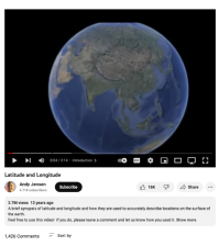
This video, created by Andy Jensen and narrated by Shant Salakian, provides a brief introduction to latitude and longitude. Salakian explains how latitude and longitude are used to describe locations on the surface of the earth. The video runs 03:14 minutes in length.
|
| ← PreviousNext → |

