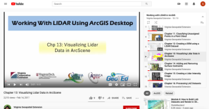
Visualizing Lidar Data in ArcScene (Chapter 13 of 16)

This video, provided by Virginia Geospatial Extension, is part of a series of 16 tutorial videos on using Lidar with ArcGIS Desktop. This tutorial demonstrates how to visualize Lidar data using ArcScene, one of the software applications of ArcGIS Desktop. This video runs 8:55 minutes in length. The other videos in the series are available to view separately.
Each video of the series corresponds to a chapter in the Working with Lidar using ArcGIS Desktop e-book by Tammy Parece, John McGee and James Campbell. This video series can be used in conjunction with the e-book or used as a stand-alone learning resource.
About this Resource
Alternate Title
Visualizing Lidar Data in ArcScene (Chapter Thirteen of Sixteen)
Date Issued
February 14th, 2017
Audience
Education Level
Language
Subject
GEM Subject
Associated Files
Archived
Rights
Access Rights
STEMLink
Available in STEMLink

Comments