Exploring Our World Through Geospatial Technology (GEOG 1890)

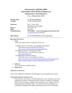
These resources include a 4-page syllabus and a 2-page course table map for the Exploring Our World Through Geospatial Technology course taught at Weber State University. "This ... exploratory course introduces [students] to the fundamental concepts of Geospatial Science and how Geospatial Technology (GST) is used to measure, imagine, study, and discover our complex and ever- changing human and natural world." This course covers the basic techniques of cartography (mapping), GPS (global positioning systems), GIS (Geographic Information Systems), spatial analysis, and remote sensing. The syllabus includes a course overview, course objectives, student learning outcomes, prerequisite information, methods of instruction, a course outline, and more. Specific course objectives include:
The course table map includes student learning objectives for each unit of the course. These learning objectives are mapped to corresponding Tier 4/5 competencies and skills from the Geospatial Technology Competency model - 2014 (GT).
About this Resource

Comments