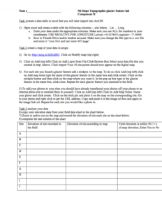
Mt. Hope Cemetery, Topography and Glacier Feature Lab: Part 2

This 2-page resource, provided by the GeoTech Consortium of Western New York, is the second part of a lab activity that has students map the latitude, longitude, elevation, and glacier feature information of Mt. Hope Cemetery. In part two of the lab, students will create an excel spreadsheet of data collected in part one, map the data in ArcGIS, and then answer questions related to the data. The lab sheet for part one includes instructions, charts for inputting data, and discussion questions.
Part one of this lab is available to view separately.
About this Resource
Alternate Title
Mt. Hope Cemetery, Topography and Glacier Feature Lab: Part Two
Resource Type
Format
Audience
Education Level
Language

Subject
GEM Subject
Relation
Associated Files
Archived
Rights
Access Rights
STEMLink
Available in STEMLink
Comments