Using Soil Productivity to Assess Agricultural Land Values in North Dakota

Learning Unit Description:
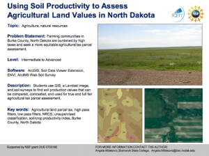
The Integrated Geospatial Education and Technology Training Project (iGETT) presents a series of Learning Units (LU) designed to incorporate federal land remote sensing data into Geographic Information System (GIS) instruction. The Using Soil Productivity to Assess Agricultural Land Values in North Dakota LU, created by Angela Milakovic of Bismarck State College, has students use GIS, a Landsat image, and soil surveys to find soil production values that can be compared, contrasted, and used for true and full fair agricultural tax parcel assessment.
The iGETT Learning Units amount to about two weeks of instruction and are designed for use both as “skills-based case studies and building blocks for new courses.” All LUs are intended for students with a basic understanding of GIS. Each LU includes three core documents, an instructor’s guide, a student guide, and a curriculum support document, as well as the remote sensing data needed to complete the unit. To complete the lesson, students must have administrative rights to the lab for downloading ESRI extensions and data sets from the Internet.
For orientation purposes, viewers should begin with Milakovic_Thumbnail.pdf, which offers a description of the LU as well as an overview of topics covered, required software, and the intended audience.
Lesson Contents:
The attached files associated with this LU exist in a variety of formats and a variety of geospatial data file types.
Below is a list of the files contained within the .zip attachment. The size of each file is included in parenthesis.
LU_Mila.zip
- Documents
- AGricultural_Land_ValuesCS.pdf (150 KB)
- Milakovic_IG_Final.pdf (159 KB)
- Milakovic_SH-Final.pdf (2.9 MB)
- Milakovic_Thumbnail.pdf (103 KB)
- ALSupport_Documents
- Assessment
- Post_Quiz.docx (12 KB)
- Pre_Quiz.docx (12 KB)
- PowerPoint_Presentations
- Thumbs.db (8 KB)
- GIS In Land Parcel Development.ppt (2.1 MB)
- NRCS_Bismarck1.ppt (3.3 MB)
- NRCS_Bismarck2.ppt (6.4 MB)
- White_Papers
- ND Legislative Council - Taxation Committee.pdf (10 KB)
- Web_Soil_Survey_Final.pdf (1.3 MB)
- ND_Tax_Inequity_Study.pdf (229 KB)
- HB1303 Soils White Paper.doc (34 KB)
- NDACo White Paper.doc (34 KB)
- Assessment
- Data
- MilaData1
- AG_Land_Taxes.mxd (66 KB)
- Images
- Layer_Files
- ras_aerialimages.lyr (12 KB)
- Scratch_Temp (32 items, 125.3 MB)
- Shapefiles (14 items, 13 KB)
- Tables
- solidb_US_2002.mdb (11.1 MB)
- Utility
- Soil Data Viewer 5.2
- Soil Data Viewer 5.2.msi (3.3 MB)
- Soil Data Viewer 5.2
- Zip
- soildb_US_2002.mbd (11.1 MB)
- soil_metadata_nd013.txt (54 KB)
- soil_metadata_nd013.xml (45 KB)
- readme.txt (5 KB)
- spatial (32 items, 41.9 MB)
- tabular (68 items, 26.3 MB)
- MilaData2
- Grids
- etp034r26_5t19910719
- p034r26_5t19910719_nn2.tif (60.5 MB)
- p034r26_5t19910719_nn3.tif (60.5 MB)
- p034r26_5t19910719_nn6.tif (60.5 MB)
- p034r26_5t19910719_nn7.tif (60.5 MB)
- p034r26_5t19910719_nn3.sta (184 bytes)
- etp034r26_5t19910719
- Grids
- MilaData3 (23 items, 255.8 MB)
- MilaData1
About this Resource


Comments